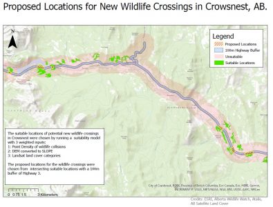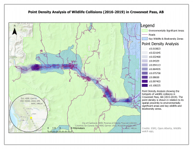
In a team of three students, we utilized data on animal-vehicle collisions, traffic patterns, elevation/slope, and species range to conduct a site suitability analysis for wildlife crossings along Crowsnest Highway in the Southern Alberta Rockies. Wildlife crossings help connect animal habitats that have been fragmented by roads and human activity. These projects usually come in the form of tunnels underneath pavement or fenced bridges over railways. By completing this analysis, we demonstrated an ability to collect and use various data while applying functions including kernel point density, suitability analysis, buffers, and clips. It was one of the most challenging yet fulfilling projects I have worked on. Our group earned an A- on the assignment.
To learn more about the project, visit our website: https://blogs.ubc.ca/wildlifecrossingsalberta/